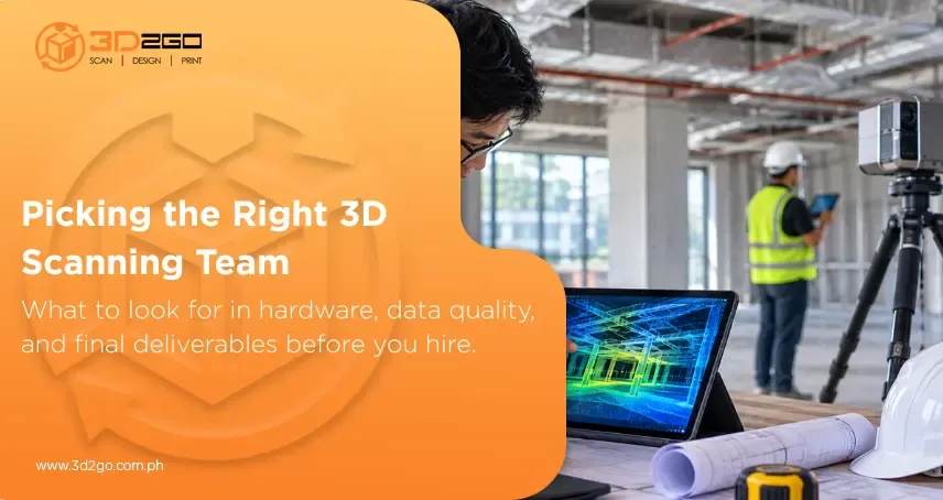
Investing in digital spatial tools isn’t just for multi-million-dollar infrastructure builds anymore. Whether you’re reconfiguring a commercial retail floor, prepping for a complex MEP retrofit, or creating a digital twin of an industrial plant, getting true site conditions early sets the trajectory for your entire project. But simply deciding to digitize your site is only half the job. The market’s full of options today—from handheld gadgets to high-precision laser setups.
Choosing between competing advanced 3D scanning technology options means looking past flashy sales pitches. To get spatial data your architects, engineers, and contractors can actually use, you need a partner who genuinely understands data processing, geometric accuracy, and real-world construction workflows. Knowing how to evaluate professional scanning services helps keep your project on schedule, avoid unbudgeted rework, and deliver a solid return on investment.
1. Hardware and Technology Capabilities
Not all 3D scanners handle the same conditions. A vendor using portable structured-light units designed for tabletop objects will struggle to map a 5,000-square-meter warehouse. On the flip side, long-range aerial tools might miss tight interior room dimensions altogether.
When weighing different professional scanning services, look closely at what they bring to your job site:
- Terrestrial Laser Scanners (TLS): High-precision tripod systems built for millimeter-accurate measurements over long distances. Ideal for detailed building facades, structural frames, and heavy plant engineering.
- Handheld and Mobile Scanners: Lightweight units suited for rapid walkthroughs, tight mechanical rooms, or awkward spots where tripods can’t stand securely.
- Airborne & Drone LiDAR: Essential for wide-area site mapping, volume tracking for earthworks, and large topographic surveys.
A top-tier provider won’t push a single tool for every job. They’ll assess your facility’s layout and deploy the right hardware combo to balance speed, coverage, and spatial detail.
2. Proven Measurement Accuracy and Data Verification
A dense 3D point cloud looks great on a monitor, but if the underlying numbers drift by even a few centimeters, your design team will hit real snags once building starts. Catching a piping clash on screen costs nothing; finding it on-site halts work and inflates your material budget.
To make sure your scan data hits that standard, ask prospective professional scanning services how they verify data quality before leaving the field:
- Do they tie their scans to established ground control points (GCPs)?
- What registration tolerances do they maintain when stitching individual scan stations together?
- Do their equipment checks align with recognized spatial measurement guidelines?
A qualified partner will happily share their accuracy reports and data verification steps before sending a crew out to your site.
3. End-to-End Data Processing and Deliverable Variety
Raw point cloud files containing millions of spatial coordinates aren’t plug-and-play assets for design teams. Most CAD tools drag or crash when loading uncompressed raw point data without proper setup.
The true value of professional scanning services happens after field technicians pack up their gear. Confirm your provider offers post-processing tailored to your team’s specific software:
- Registered Point Clouds: Clean, filtered datasets exported in standard formats (.e57, .rcp, .pts) ready to drop right into AutoCAD or Revit.
- 2D CAD Drawings: Precise floor plans, reflected ceiling plans (RCPs), structural cross-sections, and building elevations traced directly over true spatial points.
- 3D Parametric BIM Models: Intelligent Revit assets built to your needed Level of Detail (LOD 100 through LOD 300+), complete with structural and MEP elements.
- Virtual Web Walkthroughs: Browser-based 360-degree tours that let stakeholders review site details remotely without launching heavy CAD programs.
Always clarify upfront that your provider can deliver files in the exact format and LOD your design team uses every day.
4. Industry-Specific Experience and Portfolio
Scanning an active industrial chemical facility demands a totally different approach than documenting a heritage museum facade or an operational retail space. Every sector comes with its own technical constraints, safety rules, and spatial priorities.
When comparing professional scanning services, check out sample deliverables or case studies from past projects similar to yours:
| Industry Sector | Primary Scanning Objective | Critical Deliverable |
| Commercial Construction | As-built verification & structural alignment | 2D CAD floor plans & deviation analysis |
| MEP & Industrial Engineering | Pipe routing, clearance checks, clash detection | 3D Revit/Navisworks models (LOD 300) |
| Retail & Hospitality | Space planning, interior fit-outs, virtual walkthroughs | Clean point clouds & 360° virtual tours |
| Heritage & Architecture | Facade restoration, non-invasive archiving | High-density mesh models & orthophotos |
Experienced professional scanning services know how to work around active job sites without disrupting your daily operations or compromising site safety.
5. Clear Communication and Early Consultation
A smooth mapping project depends on clear communication long before equipment lands on site. Reputable providers walk you through a clear scoping step to align expectations early.
During your initial conversation, see how openly they address key details:
- Site Access Requirements: Do they check lighting, safety clearances, and operational hours ahead of time?
- Turnaround Timelines: Can they give you a clear schedule for capture, registration, and final CAD/BIM drafting?
- Data Storage & Transfer: Point cloud files run anywhere from 10 GB to well over 100 GB. How do they handle secure transfers, local archives, and privacy?
Working with a responsive team that asks smart scoping questions up front keeps your project moving smoothly without surprise add-ons down the line.
6. Long-Term Value vs. Upfront Costs
It’s tempting to grab the lowest quote when comparing professional scanning services. But rock-bottom estimates usually mean shortcuts during data processing—like noisy point clouds, loose scan registration, or unverified drafting work.
Fixing inaccurate CAD plans halfway through construction costs far more than hiring a qualified team from day one. When reviewing quotes, look for clear itemized breakdowns covering:
- Mobilization and field capture hours
- Scan registration and point cloud cleaning
- Specific CAD or BIM deliverable creation
- Final quality control and data review
Investing in vetted professional scanning services protects your build budget by wiping out expensive field change orders down the road.
Partner with 3D2GoPH for Your Next Spatial Survey
Accurately capturing physical sites requires the right hardware, skilled data processing, and localized technical know-how. Partnering with an established local provider removes measurement guesswork and keeps your engineering and design teams aligned from day one through final sign-off.
3D2GoPH supports architects, contractors, facility managers, and interior designers across the Philippines with end-to-end spatial documentation. As the country’s leading full-service 3D technology hub, we handle every stage under one roof—from on-site laser scanning and point cloud registration to delivering ready-to-use 2D CAD layouts, 3D Revit models, and virtual site walkthroughs. Whether you’re planning a boutique commercial fit-out or documenting an expansive industrial plant, our field team delivers dependable professional scanning services built for real-world execution.
Don’t let manual measuring delays slow down your project timeline. Contact our spatial mapping specialists today to book your 3D site survey and streamline your project workflow.
Key Takeaways
- Check Hardware & Standards: Make sure your provider uses gear matched to your facility size and maintains strict registration accuracy.
- Focus on Usable Deliverables: Choose a partner who turns raw point data into clean 2D CAD drawings or 3D BIM models ready for your software.
- Look for Industry Practice: Select providers with a clear track record handling similar site conditions, safety rules, and structural needs.
- Prioritize Total ROI: High-quality spatial capture prevents costly job-site change orders, far outweighing initial survey costs.