How LiDAR Scanning Services Improve Urban Planning and Smart City Projects
October 17, 2025
How Can Aerial Scanning LiDAR Strengthen Earthquake-Resilient Infrastructure in the Philippines
October 31, 2025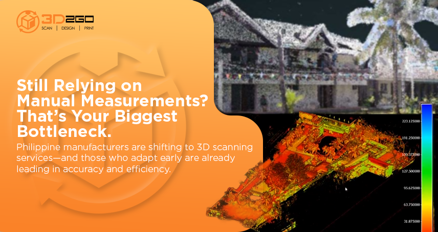
Precision drives progress in modern manufacturing. And for Philippine industries aiming to compete globally, accuracy is the key that unlocks both speed and efficiency. More companies now rely on 3D scanning services Philippines to optimize workflows, reduce production errors, and maintain consistent product quality.
These services go far beyond simple measurements. They create exact digital replicas of physical objects—turning every surface, curve, and edge into precise data. It’s not just technology; it’s a more innovative way of manufacturing.
The New Standard of Manufacturing Precision
Manufacturing used to rely on manual measurements and prototype testing. Those methods worked—but they also left plenty of room for human error. 3D scanning services completely changed that dynamic.
This technology captures millions of data points in seconds, producing a detailed 3D model that engineers can instantly inspect, edit, and refine. The result? Shorter design cycles, fewer mistakes, and more efficient production.
According to a study, over 60% of manufacturers that integrate 3D scanning and digital modeling into their workflows report improved productivity and faster time-to-market. That’s not just a statistic—it’s proof of how digital precision fuels real-world performance.
Why Manufacturers in the Philippines Are Adopting 3D Scanning
For manufacturers across the Philippines, 3D scanning services provide a competitive edge in a fast-paced market. Whether producing automotive components, metal parts, or complex molds, precision matters.
Here’s why it’s changing the game:
- Speed and Detail: Scans are completed in minutes, delivering data with micron-level accuracy.
- Repeatable Consistency: Every production batch stays identical to the original design.
- Waste Reduction: Detects flaws early to prevent costly material losses.
- Cross-Industry Application: From electronics to construction, scanning adapts to any manufacturing need.
- Better Collaboration: Designers, engineers, and production teams can all work from one reliable digital model.
It’s a perfect blend of speed, efficiency, and insight that traditional methods can’t match.
Inside the Process of 3D Scanning Services
Understanding the process behind 3D scanning services reveals why it’s such a trusted tool in manufacturing:
- Data Collection: Scanners capture millions of measurement points using lasers or structured light.
- Point Cloud Generation: These data points form a 3D “cloud” that replicates the physical object’s surface.
- Data Refinement: The software filters and aligns the scans to produce cleaner, sharper results.
- Model Creation: The refined data is turned into a usable 3D CAD model.
- Inspection or Reverse Engineering: Engineers analyze, compare, or recreate precise components as needed to ensure accuracy and reliability.
This entire workflow saves time, improves accuracy, and enables manufacturers to detect even the smallest imperfections before they become costly problems.
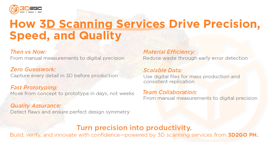
How 3D Scanning Improves Efficiency Across Production
Beyond accuracy, 3D scanning services reshape how production teams operate. Every phase—from design to quality control—becomes faster and more coordinated.
When teams can visualize data in real-time, they eliminate the guesswork that slows down projects. This leads to:
- Shorter turnaround times.
- Higher design accuracy.
- Smoother collaboration across departments.
- Better decisions backed by measurable data.
It also integrates seamlessly with other digital tools, such as CAD and 3D printing, creating an ecosystem that enhances the entire manufacturing workflow.
Powering the Future of Philippine Manufacturing
The Philippines is steadily positioning itself as a hub for innovation and excellence in production. But to stay ahead, manufacturers must embrace technologies that deliver both precision and scalability. That’s where 3D scanning services step in.
This technology future-proofs businesses by merging craftsmanship with automation. It empowers industries to produce at a higher quality, with lower waste and faster execution. As global standards continue to rise, those who invest in advanced scanning will set themselves apart—not just for efficiency, but also for reliability.
Partner with Experts Who Understand Precision
Manufacturing success starts with data—and 3d2goPH makes that data work for you. Our team specializes in delivering 3D scanning services that meet the highest standards of accuracy and speed. From intricate industrial components to large-scale production parts, we help businesses achieve perfection in every detail.
Ready to improve accuracy and accelerate production? Reach out today: 3d2go PH