Every major construction, renovation, or infrastructure project starts with one crucial requirement: knowing the site’s exact physical reality. For decades, project managers and survey teams relied on manual tape measurements, traditional total stations, and two-dimensional topographic drafts. While these methods served their purpose in simpler times, modern construction timelines and complex architectural designs leave no room for human error. A single overlooked elevation drop or miscalculated wall offset during initial survey work can trigger a domino effect of costly design revisions, material waste, and on-site structural delays.
Modern site capture eliminates those blind spots completely. By integrating high-definition 3D laser scanning with modern spatial data processing, project teams can digitize entire physical environments down to the millimeter. Utilizing professional lidar services ph providers allows contractors, architects, and site developers to capture full-scale spatial topography, existing structures, and complex utility lines in a fraction of the traditional timeframe. This high-precision approach creates a reliable digital foundation for every phase of building development.
Why Construction Projects Are Ditching Traditional Site Surveys
Traditional surveying methods take time—lots of it. Setting up tripods across active sites, taking point-by-point measurements, and manually inputting survey coordinates into CAD software usually drags on for days or weeks. Beyond the labor costs, hand-measured data inherently carries risk:
- Incomplete Surface Coverage: Manual surveys capture only discrete data points, leaving wide gaps between readings where hidden terrain dips or structural warps can easily be missed.
- Safety Risks on Active Sites: Sending survey crews into hazardous locations—such as steep embankments, unstable structures, or busy roadway expansions—puts personnel in harm’s way.
- Costly Redesign Cycles: Discovering site discrepancies during the active build phase forces engineers to issue emergency field changes, driving up material costs and stalling work crews.
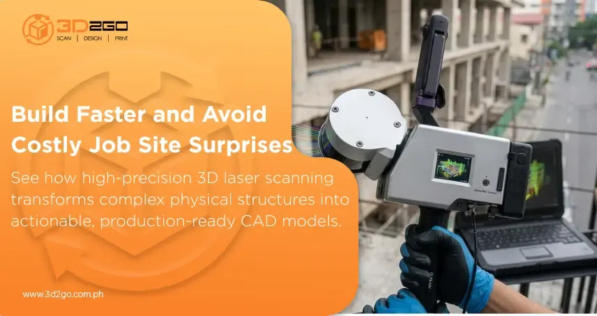
Deploying specialized lidar services ph fixes these issues by firing hundreds of thousands of laser pulses every second across the site. This non-contact tech sweeps entire spaces quickly, capturing dense point cloud data that records every beam, pipe, and wall safely from a distance. According to construction technology benchmark research, implementing digital spatial capture tools like 3D laser scanning can shorten project timelines and reduce overall costs by eliminating design-to-build discrepancies long before construction begins.
Where LiDAR Data Delivers the Highest Value
LiDAR isn’t just a fancy substitute for a surveyor’s level—it’s a core tool for making smart design decisions throughout a project’s lifespan. Partnering with LiDAR services ph specialists opens up clear advantages across critical project phases:
- Building Information Modeling (BIM) & Scan-to-BIM: Convert raw physical point clouds into parametric 3D BIM models (REVIT/STEP) for clash detection and seamless MEP (mechanical, electrical, plumbing) routing.
- Renovation & As-Built Documentation: Capture legacy structures, commercial facilities, or historic sites where original blueprints are outdated or missing entirely.
- Quality Assurance & Progress Tracking: Periodically scan active job sites to overlay physical progress against architectural models, catching structural shifts before drywall goes up.
- Structural Deformation & Verticality Checks: Measure wall tilt, floor flatness, and beam deflection across existing buildings before adding heavy structural loads.
Relying on experienced LiDAR service providers keeps project managers in complete control of site realities without wasting hours on manual checks.
How Terrestrial LiDAR Capture Works: From Field Sweep to 3D Model
LiDAR operates by shooting rapid laser beams at target surfaces and timing how quickly each pulse bounces back to the sensor. That simple measurement generates millions of precise XYZ coordinate points that combine into a high-density digital point cloud.
When you hire specialized lidar services and teams, your site data moves through a clear, disciplined pipeline:
- Site Walk & Control Setup: Surveyors evaluate target spaces, set up physical control targets using high-accuracy GPS or total stations, and mark scanner setups to eliminate blind spots.
- High-Precision Ground Scanning: Tripod-mounted terrestrial laser scanners sweep the site, logging millions of geo-referenced spatial coordinates and high-res imagery from multiple positions.
- Point Cloud Registration & Clean-Up: Technical staff stitch separate scan passes into one unified coordinate system using specialized point-cloud processing software.
- CAD/BIM Conversion: Drafters and engineers translate the cleaned point cloud into actionable 2D CAD line drawings or fully populated 3D BIM models ready for design software.
- Quality Verification: The final digital files undergo strict accuracy checks against ground targets before delivery to your architectural or engineering team.
A structured lidar services ph workflow makes sure your project team receives clean, production-ready CAD models they can use right away.
Ground-Based Terrestrial LiDAR: Built for Unmatched Precision
When structural accuracy matters most, high-precision terrestrial laser scanning (TLS) is the industry standard. Stationed firmly on ground tripods, terrestrial systems deliver sub-millimeter detail that higher-altitude gear just can’t touch.
By focusing on ground-level lidar services ph, your project benefits from pinpoint accuracy across dense indoor layouts, complex structural framing, intricate building facades, and tight utility corridors. Terrestrial setups eliminate wind wobble and GPS signal loss, ensuring every column, pipe run, and floor slab aligns perfectly with true field measurements.
Building a “Digital Twin” for Facility Management
The benefits of a LiDAR scan don’t stop once construction finishes. The complete spatial dataset lives on as a “digital twin”—a precise virtual model of the building as it was actually constructed.
Using LiDAR services ph for as-built records gives facility directors and maintenance crews a permanent, digital roadmap of the property. When plumbing issues pop up, electrical runs need upgrading, or wall layouts get rearranged years later, facility managers can check the digital twin to locate hidden conduit runs and structural supports behind walls without cutting blind exploratory holes.
Adopting digital twin asset management through lidar services ph lowers ongoing repair costs, avoids surprise disruptions, and protects your real estate investments for years to come.
Build with Confidence Using Precision Site Data
Surprises on a job site usually mean one thing: unexpected costs. Relying on incomplete hand measurements or outdated blueprints for structural decisions or architectural plans puts your project schedule and budget at serious risk.
3D2GoPH helps builders, architects, and engineering firms eliminate spatial uncertainty. As a full-service 3D technology provider in the Philippines, we handle the whole spatial pipeline under one roof—from high-definition terrestrial LiDAR field capture and point cloud processing to custom 3D CAD drafting and digital asset creation. Our team delivers accurate, actionable site models tuned to your exact project needs.
Stop letting manual survey mistakes or unexpected field clashes slow down your project. Get in touch with us today and capture your job site with absolute precision!