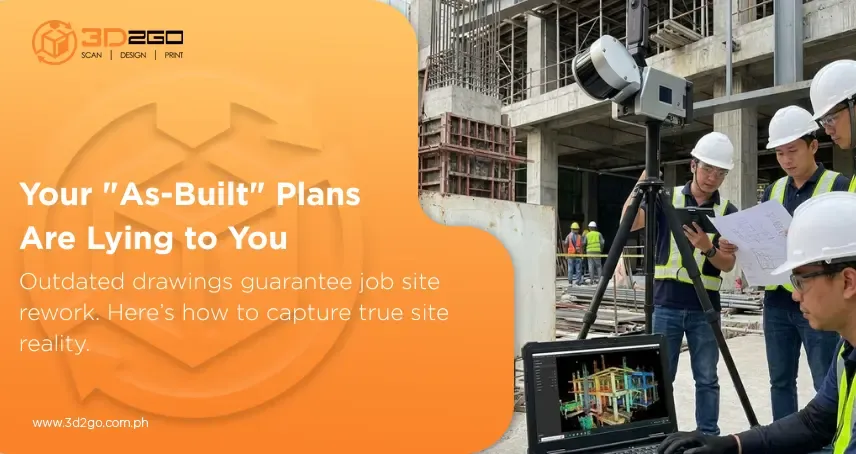
Every renovation, expansion, or retrofit project starts with the same question: what is actually on the job site? Relying on decades-old paper blueprints, incomplete CAD files, or manual tape-measure surveys is a gamble that rarely pays off. Unmapped structural shifts, hidden plumbing lines, and warped walls can derail project schedules. When design teams rely on inaccurate site data, emergency field fixes during construction quickly burn through budgets and stall crews.
Modern spatial technology eliminates that guesswork. High-precision LiDAR building documentation services in the Philippines let architects, engineers, and project leads digitize physical structures into detailed, interactive 3D models. Adopting 3D building documentation gives your team a rock-solid, millimeter-accurate digital starting point, creating a reliable foundation long before construction crews arrive on site.
The Hidden Costs of Old-School As-Built Records
Traditional surveying methods—like hand-measuring rooms with tape measures or setting up optical levels—were built for simpler times. On modern, complex commercial and industrial job sites, those manual techniques hit clear limits:
- Blind Spots and Missing Detail: Manual surveys only capture scattered points, leaving huge unmeasured gaps where structural bow, floor slope, or overhead pipe runs go unnoticed.
- Human Error in Transcribing Notes: Hand-recorded measurements and manual drafting sketches frequently miss critical details, causing design clashes once installation starts.
- Safety Risks in Hard-to-Reach Areas: Sending survey teams into tight mechanical rooms, elevated rafters, or unstable structures puts workers directly in harm’s way.
- Expensive Field Rework: Catching a conflict between a new HVAC duct and a concrete beam during buildout halts work, wastes materials, and consumes valuable labor hours.
Bringing in 3D building documentation fixes these operational headaches by capturing millions of spatial coordinate points across a site in minutes. Construction technology benchmark research shows that implementing digital spatial capture tools and building information modeling (BIM) can cut total project completion times by up to 15% and reduce overall project costs by 10% to 20% by eliminating design-to-build discrepancies early in the process.
Where 3D Site Capture Delivers the Highest Value
Digital site capture isn’t just a one-off task for the start of a project. Using comprehensive 3D building documentation pays off across the entire lifecycle of a facility:
- Renovation and Adaptive Reuse: Capture legacy structures, heritage sites, or commercial properties where original blueprints are missing or hopelessly out of date.
- Scan-to-BIM Conversion: Translate raw point cloud data into parametric 3D BIM models (such as Revit or STEP files) for clash detection and seamless MEP (mechanical, electrical, plumbing) routing.
- Structural Deformation Checks: Measure wall tilt, floor flatness, and beam deflection across existing structures before adding heavy load-bearing elements.
- Progress Audits & As-Built Verification: Scan active job sites periodically to overlay physical progress against architectural models, catching structural shifts before drywall goes up.
Relying on experienced 3D building documentation specialists keeps project managers in complete control of site realities without wasting weeks on manual checks.
How 3D Building Documentation Works: From Scan Pass to Final Model
Building a clean, high-density spatial dataset takes a disciplined engineering pipeline. When you bring in specialized teams for 3D building documentation, your job site moves through five clear steps:
- Site Assessment & Control Setup: Technicians evaluate the target space, set up physical survey targets, and map out scanner placements to ensure complete line-of-sight coverage without blind spots.
- Terrestrial Laser Scanning: Tripod-mounted 3D laser scanners sweep the site, firing hundreds of thousands of laser pulses every second to log precise XYZ spatial coordinates and high-res imagery.
- Point Cloud Registration: Specialized processing software stitches separate scan passes into one unified, geo-referenced coordinate system.
- CAD and BIM Drafting: Experienced technicians translate the cleaned point cloud into 2D architectural drawings (floor plans, elevations, cross-sections) or fully populated 3D BIM models.
- Quality Verification: We run strict accuracy checks against ground control targets before delivering final digital files to your architectural or engineering team.
A structured 3D building documentation workflow ensures your design team receives clean, production-ready files they can trust from day one.
Terrestrial LiDAR: The Gold Standard for Structural Accuracy
When millimeter precision matters most, tripod-mounted terrestrial laser scanning (TLS) is the industry benchmark. Firmly anchored to the ground, terrestrial setups deliver sub-millimeter detail that higher-altitude gear can’t match indoors or around complex structural framing.
Prioritizing ground-based 3D building documentation lets you record intricate details across dense indoor layouts, cramped mechanical rooms, intricate facades, and tight utility corridors. Terrestrial setups eliminate wind wobble and GPS signal loss, ensuring every column, beam, and pipe run aligns with true field measurements.
Long-Term Value: Digital Twins for Facility Management
The benefits of spatial documentation extend far past handoff day. Once construction wraps up, your complete spatial dataset lives on as a permanent “digital twin”—an exact virtual replica of the building as it was actually constructed.
Relying on 3D building documentation for asset management gives facility managers a permanent digital roadmap of the property. When plumbing issues arise, electrical runs need upgrading, or tenant spaces are reconfigured years later, team members can check the digital twin to locate hidden conduit runs and structural supports behind walls without cutting exploratory holes.
Maintaining an active record of 3D building documentation lowers ongoing maintenance costs, prevents surprise disruptions, and protects your real estate investments for years to come.
Build with Confidence Using Precision Site Data
Job-site surprises usually mean one thing: unexpected costs. Relying on incomplete hand measurements or outdated blueprints for structural decisions or architectural plans puts your project budget and schedule at serious risk.
3D2GoPH helps builders, architects, facility managers, and engineering teams eliminate spatial uncertainty. As a full-service 3D technology provider in the Philippines, we handle the whole spatial pipeline under one roof—from high-definition terrestrial LiDAR field capture and point cloud registration to custom 3D CAD drafting, Scan-to-BIM modeling, and digital asset creation. Our team delivers accurate, actionable site models tuned to your exact project needs.
Don’t let manual survey mistakes or hidden structural clashes delay your project timeline. Skip the guesswork and build with total precision. Contact our team today to capture your job site with absolute accuracy!