How a 3D Modeling Company Delivers Custom 3D Design Solutions That Work
June 30, 2025
Beyond Design: How 3D Modeling Drives Business Results
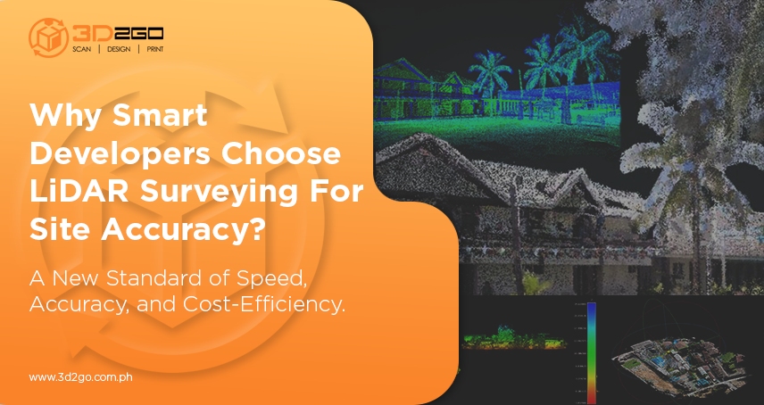
July 7, 2025Precision and speed are crucial in today’s fast-paced real estate and construction industries. As a result, developers are increasingly utilizing the 3D laser scanning particularly the LiDAR services as a tool to achieve unparalleled site accuracy. LiDAR utilizes laser-based data and sophisticated processing tools to make decisions more intelligently, project timeframes more accurately, and make field activities more economical.
What Is LiDAR Services
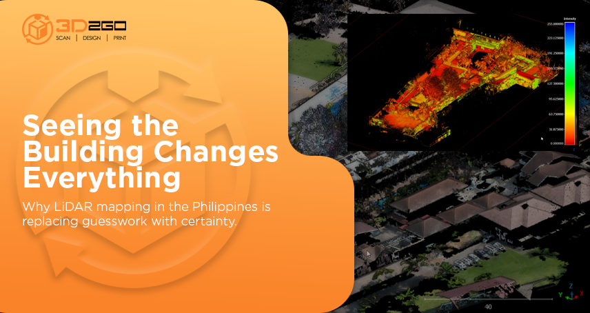
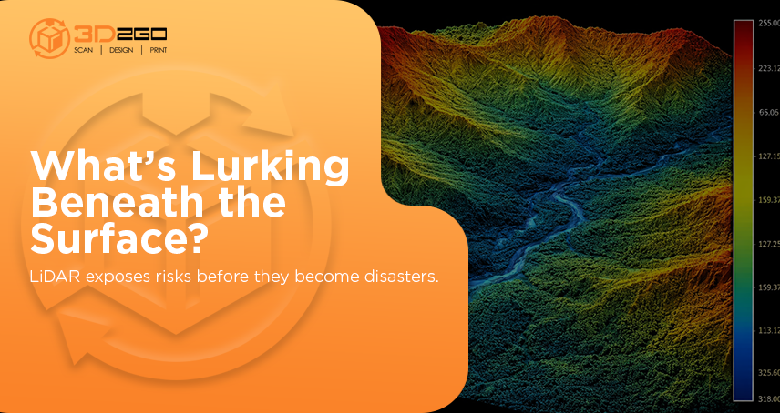
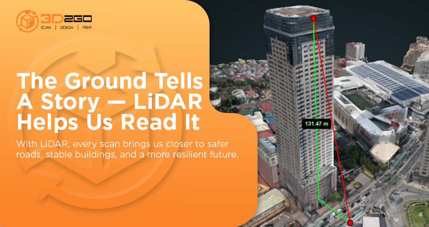
The remote sensing method known as LiDAR, or Light Detection and Ranging, uses thousands of laser pulses per second to create incredibly detailed maps of the Earth’s surface. A 3D point cloud that records elevation, vegetation, structures, and even minute site differences down to a few millimeters is produced when these pulses return to the sensor.
LiDAR services give you the advantage you require, particularly when conventional surveying techniques are insufficient, whether you’re tackling urban development, coastal erosion, or uneven terrain.
Why Developers in the Philippines Embrace LiDAR Services
Fast and Comprehensive Data Collection
Typical questionnaires? They do the job, but they are frequently labor-intensive, slow, and prone to mistakes in rugged terrain. Teams can quickly scan a land area with LiDAR, guaranteeing consistent data quality throughout your project site.
Highly Detailed 3D Models
With sub-meter accuracy, the LiDAR-generated 3D point clouds record surface details, structural alterations, and micro-elevations. These particulars are crucial for engineers establishing drainage pathways or architects planning foundations.
Safer, Remote-Friendly Operations
Do you need to scan a steep valley, a dense forest, or a cliff face? Drones equipped with LiDAR technology complete the task remotely, reducing surveyor danger and eliminating the need for site entry that requires numerous permissions.
Faster Planning and Smarter Decisions
Digital data processing enables near real-time sharing and visualization of information. You won’t have to wait days to examine detailed topographical maps or determine whether a spot is suitable. Instead, you use that time to make real planning choices.
Helps Future-Proof the Site
Digital data processing enables the near real-time sharing and visualization of Current circumstances. Circumstances are captured with millimeter accuracy by as-built LiDAR scans. Developers have dependable baseline data when planning future additions, renovations, or infrastructure upgrades, eliminating surprises and guesswork.
Common LiDAR Services Applications for Philippine Projects
LiDAR services are being used in local projects in the following ways by developers:
- Slopes, flood zones, and cut/fill calculations are all made easier with accurate 3D terrain mapping in land development and master planning.
- Measure current building heights, right-of-way widths, and concealed utilities for redevelopment in urban infill projects.
- Feasibility in establishing solar and wind farms as government projects.
- Coastal and shoreline monitoring: Keep tabs on shoreline changes or beach erosion in real-time, which is crucial for properties close to the coast.
- LiDAR speeds up subsurface design for utility networks, roads, and bridges in infrastructure projects.
- Environment & Forestry: Measure tree heights and canopy cover for projects including carbon assessment or eco-redevelopment.
LiDAR vs Traditional Surveying: What Sets Them Apart
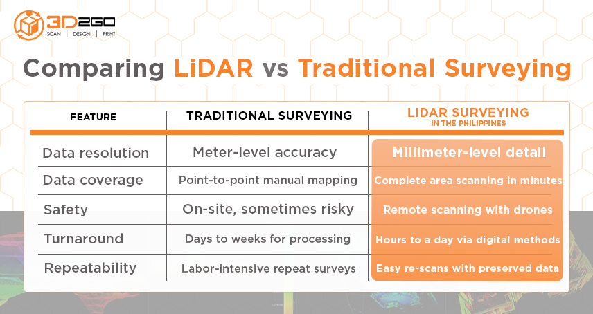
When it comes to data resolution, traditional surveying typically offers meter-level accuracy, while LiDAR surveying in the Philippines delivers millimeter-level detail for highly precise outputs.
In terms of data coverage, traditional methods rely on point-to-point manual mapping, whereas LiDAR can scan an entire area in just minutes.
From a safety perspective, traditional surveying often requires personnel to be physically on-site, sometimes in risky conditions, while LiDAR allows for remote scanning via drones, significantly reducing exposure.
Looking at turnaround time, traditional surveys may take days or even weeks to process, while LiDAR can deliver results in a matter of hours, thanks to its digital efficiency.
Finally, in terms of repeatability, traditional surveying is labor-intensive and time-consuming for repeat surveys, while LiDAR enables easy re-scans with all data digitally preserved for future use.
What to Expect from Top LiDAR Services Provider
When selecting a partner for Lidar services in the Philippines, here are the key traits developers look for:
1. Trusted equipment and technology
- Advanced GNSS devices, LiDAR sensors, and aerial platforms
- Completely adjusted equipment for reliable accuracy
2. Teams of skilled survey and data analysis personnel
- Crews with expertise who are aware of local regulations and terrain
- CAD/GIS experts with certification who can process point clouds
3. Quick response time plus pristine digital delivery
- Current surface models .LAS/.LAZ datasets with accuracy
- Possibility of interface with ArcGIS, Revit, Civil3D, and BIM
4. Secure processes combined with local compliance
- Drone flying permissions in restricted areas
- Backups, data security, and geo-tagging uniformity
5. Reasonably priced and personalized packages
- Reasonably priced turnkey, per-hectare, or per-hour
- The ability to scan small properties or entire development sites
Boost Your ROI with LiDAR Surveying
Save Time with Site Logistics
- Steer clear of in-field stakeouts and manual grid layouts. A single drone trip can replace weeks of pole measurements and the work of ground workers.
Minimize Reworks and Change Orders
- Unexpected circumstances at the site? Before you construct a slab or foundation, LiDAR provides you with unambiguous, ground-truth data, removing any surprises.
Enhance Communication with Stakeholders
- Real-time landscape models and 3D visualizations enable developers, engineers, and community stakeholders to gain a thorough understanding of the project before work begins.
A consideration for future upkeep
- You can increase the return on your initial investment by keeping a LiDAR scan on file for future owners or contractors to use when planning improvements or retrofits.
Why 3D2GO Stands Out in Philippine LiDAR Services
By selecting 3D2GO, you will be collaborating with a team that has already mapped hundreds of hectares throughout the Philippines, combining technical know-how with local understanding.
- We use advanced LiDAR equipment and uncrewed aerial vehicles to collect extensive point clouds.
- From tools, setup, to data processing, our staff handles everything so you don’t have to.
- We provide high-quality outputs that integrate with any CAD, GIS, or BIM process.
- Even better, your finished models include site snapshots, geo-coordinates, and data backup.
3D2GO offers adaptable LiDAR services that scale with your project, regardless of the site’s size—from a modest residential area to a large mixed-use complex. You pay for what you need with transparent pricing, ensuring no unused seats or unexpected costs.
Lidar services in the Philippines are now a necessity for modern developers, not just a choice. By providing accurate, effective, and future-structured site data, LiDAR-driven insights lower risk, save expenses, and improve project clarity right from the start.
Additionally, 3D2GO provides a smooth, knowledgeable, and reliable local partner for teams looking for one. With our LiDAR surveying services’ demonstrated field experience, customized project delivery, and round-the-clock assistance, you can confidently move from concept to construction.
Ready to get started?
Explore how 3D2GO’s LiDAR solutions can elevate your next development. Contact us today for a free quote—and build with precision.


