How Scanning Creates Accurate Digital Replicas of Real-World Objects
July 2, 2024
Why is Lidar technology crucial for design, construction, and mapping?
September 28, 2024Lidar, which stands for Light Detection and Ranging, is a remote sensing technology that uses laser light to map out and measure distances. This technology works by emitting laser pulses and measuring the time it takes for the light to return after hitting a surface. The data collected from these reflections allow Lidar systems to generate highly accurate 3D models of physical environments. From its beginnings in the mid-20th century to its modern applications, Lidar has revolutionized the fields of mapping, surveying, and 3D modeling.
In the 3D industry, Lidar plays an increasingly significant role, especially in 3D scanning and modeling, both of which are key services offered by our company. As Lidar technology continues to improve, it is not only becoming more accessible but also more efficient, allowing companies to create highly detailed and accurate digital representations of objects and environments. For instance, the Go Slam T100 Lidar scanner, which we recently acquired, exemplifies the cutting-edge potential of Lidar technology, enabling faster and more precise scans that enhance the overall 3D services we offer.
In the Philippines, Lidar has been used in various fields to support projects in architecture, environmental management, disaster risk reduction, and more. For instance, the National Mapping and Resource Information Authority (NAMRIA) uses Lidar to create detailed topographic maps of the country, aiding in land use planning and natural disaster preparedness. Additionally, the University of the Philippines (UP) spearheaded the Phil-LiDAR 1 and 2 projects, which utilized Lidar technology to map out flood-prone areas and create agricultural resource maps. These initiatives show how Lidar is a crucial tool in the development of resilient infrastructures and the promotion of sustainable development in the country.
Applications of Lidar in the Philippines
- Disaster Risk Management
The Philippines, being an archipelago vulnerable to natural disasters such as typhoons, floods, and landslides, greatly benefits from Lidar technology. One of the notable applications is in disaster risk reduction and management. For example, the Phil-LiDAR 1 project focused on creating high-resolution flood hazard maps to predict areas at risk of flooding, especially during typhoon season. By providing highly accurate elevation models and identifying areas of concern, Lidar helps communities and local government units (LGUs) prepare better evacuation plans and disaster responses. - Urban Planning and Development
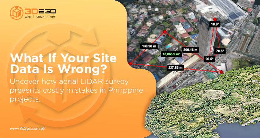
Cities in the Philippines, such as Metro Manila, have turned to Lidar technology to assist in urban planning. The Metro Manila Development Authority (MMDA) and other local government bodies use Lidar to map out existing infrastructures and create accurate 3D models that serve as references for new development projects. This is especially useful for preventing urban sprawl and ensuring efficient land use in congested metropolitan areas. By providing a comprehensive overview of buildings, roads, and other physical elements in a city, Lidar facilitates more organized development plans. - Environmental Conservation
The Department of Environment and Natural Resources (DENR) has employed Lidar in efforts to monitor and protect the country’s natural resources. Lidar helps in tracking deforestation and mapping critical ecosystems such as mangroves and coral reefs. Lidar’s precise measurements make it easier to assess changes in land cover over time, ensuring that conservation efforts are based on solid data. One of the most significant efforts using Lidar was mapping the protected areas in Palawan, allowing environmentalists to study how human activities, such as illegal logging or mining, affect the ecosystems. - Infrastructure and Engineering
Lidar is a game-changer in large-scale infrastructure projects, such as the construction of highways, railways, and bridges. Engineering firms in the Philippines leverage Lidar’s ability to produce high-accuracy topographic maps, making the planning and design of infrastructure much more efficient. For instance, when building the Cebu-Cordova Link Expressway, Lidar was employed to assess the seabed and land elevations, allowing for more informed decisions regarding the placement of foundations and the overall design of the expressway. With Lidar’s ability to generate precise data, projects can be completed faster and with fewer errors, saving time and reducing costs.
How Lidar Technology Benefits Our 3D Company
At our 3D company, specializing in 3D printing, scanning, and modeling, Lidar technology has become indispensable for providing accurate and reliable services. Here’s how Lidar contributes to the success of our projects:
- Precision and Accuracy
The hallmark of Lidar technology is its ability to deliver centimeter-level accuracy. Whether we are scanning an architectural site, a historical landmark, or creating digital models for virtual environments, Lidar ensures that every detail is captured with precision. This level of accuracy is particularly beneficial for industries like architecture and construction, where detailed 3D models are crucial for planning and visualization. - Speed and Efficiency
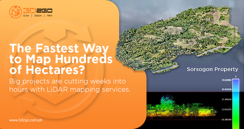
Using Lidar systems like the Go Slam T100, we can scan vast areas or objects in a fraction of the time that traditional methods would require. This speed allows us to take on more projects without compromising on quality. For example, when scanning large-scale environments like factories or landscapes, Lidar significantly reduces the time spent on-site while delivering data faster, which is invaluable in industries where time is a critical factor. - Versatility Across Various Industries
Lidar is not limited to just one or two industries; its applications span across numerous sectors. In the Philippines, our Lidar services have been utilized by industries such as telecommunications for mapping cell tower placements, mining for assessing terrain, and interior design for capturing precise room dimensions. This versatility allows us to offer a wide range of 3D services to diverse clients, each with unique needs. - Integration with 3D Printing and Modelling
One of the most exciting aspects of using Lidar in our company is its seamless integration with 3D printing and modeling. After capturing data with Lidar, we can easily process it into 3D models, which can then be printed or used in various applications, from virtual reality simulations to architectural presentations. The transition from scan to model is smooth, and it enables us to offer a complete end-to-end service, from scanning to finished product.
Lidar’s Future in the Philippines
As technology continues to evolve, the future of Lidar in the Philippines looks promising. With the country’s ongoing focus on infrastructure development and disaster risk reduction, the demand for Lidar services is expected to grow. Furthermore, as Lidar systems become more accessible, even small businesses and startups will be able to harness its power, driving innovation in various industries.
In our company, we see Lidar as an essential component of the services we offer. By staying on top of Lidar trends and continuously improving our skills and technology, we ensure that we provide the highest level of service to our clients. Whether it’s helping architects design smarter cities, aiding environmentalists in conservation efforts, or working with engineers on infrastructure projects, Lidar remains a critical tool for shaping the future of the Philippines.
Conclusion
Lidar technology, with its unparalleled precision and wide-ranging applications, has transformed industries not only globally but also within the Philippines. From disaster risk management to urban planning and infrastructure, Lidar has proven to be an invaluable asset in addressing the country’s unique challenges. For our 3D company, Lidar is more than just a tool—it’s a gateway to offering cutting-edge solutions that help our clients thrive in an increasingly data-driven world. As we continue to integrate Lidar into our operations, we are excited to see how it will shape the future of 3D services and beyond.


